


Voting District 3136, Spokane County, Washington
About
Outline

Summary
| Unique Area Identifier | 689454 |
| Name | Voting District 3136 |
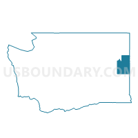
| County | Spokane County |
| State | Washington |
| Area (square miles) | 0.27 |
| Land Area (square miles) | 0.27 |
| Water Area (square miles) | 0.00 |
| % of Land Area | 100.00 |
| % of Water Area | 0.00 |
| Latitude of the Internal Point | 47.69060950 |
| Longtitude of the Internal Point | -117.41807590 |
Maps

Graphs
Select a template below for downloading or customizing gragh for Voting District 3136, Spokane County, Washington


Neighbors
Neighoring Voting District (by Name) Neighboring Voting District on the Map
- Voting District 3119, Spokane County, WA
- Voting District 3120, Spokane County, WA
- Voting District 3124, Spokane County, WA
- Voting District 3125, Spokane County, WA
- Voting District 3128, Spokane County, WA
- Voting District 3141, Spokane County, WA
- Voting District 3145, Spokane County, WA
Top 10 Neighboring County Subdivision (by Population) Neighboring County Subdivision on the Map
Top 10 Neighboring Place (by Population) Neighboring Place on the Map
Top 10 Neighboring Unified School District (by Population) Neighboring Unified School District on the Map
Top 10 Neighboring State Legislative District Lower Chamber (by Population) Neighboring State Legislative District Lower Chamber on the Map
Top 10 Neighboring State Legislative District Upper Chamber (by Population) Neighboring State Legislative District Upper Chamber on the Map
Top 10 Neighboring 111th Congressional District (by Population) Neighboring 111th Congressional District on the Map
Top 10 Neighboring Census Tract (by Population) Neighboring Census Tract on the Map
- Census Tract 14, Spokane County, WA (6,244)
- Census Tract 20, Spokane County, WA (4,205)
- Census Tract 19, Spokane County, WA (3,527)
- Census Tract 13, Spokane County, WA (3,443)
- Census Tract 12, Spokane County, WA (2,216)